

Project Overview
To access the screen reader friendly version, click on any of the links below and download the document. A physical copy of the approved Plan is available at City Hall and each of the city's five libraries.
- The approved Comprehensive Land Use Plan - 2050
- Appendices
What is a Comprehensive Land Use Plan (Comp Plan)?
A Comprehensive Plan is a document that sets out the city’s future vision and priorities to guide development to 2050. The plan includes decisions on land use policy and spending priorities for public projects over a 20 to 30 year horizon. Cities make or update these plans about every 10 years so their vision to guide growth is current and follows best practices (more on the relationship between the Comp Plan and zoning in the FAQ).
Why is the Comp Plan important?
- It provides justification for decision-making - an objective and values-driven basis to support land use and zoning decisions.
- The Comp Plan is then used as the basis for updating the Zoning Ordinance, which is local law that regulates land use.
- It is how a community can balance competing interests.
- It helps determine how best to allocate and leverage resources (i.e., infrastructure, incentives).
What are the city's core values for the Comp Plan?
Ann Arbor strives to be...
- Affordable: ALL should have the opportunity to call Ann Arbor home and thrive, residents and business alike
- Equitable: Ensure community health, safety, and equal access to essential services and amenities for ALL, with additional resources for disinvested communities
- Sustainable: Committed to promoting balance between ALL of our natural and human systems to support a healthy and biodiverse ecosystem, today and into the future
- Dynamic: To be vibrant, continuously evolving city to meet the changing needs of ALL of its people and communities
The Comprehensive Plan will replace five existing plans.
- The Natural Features Master Plan (PDF) - 2004
- The Land Use Element (PDF) - 2009
- The Downtown Plan (PDF) - 2009
- The Sustainability Framework (PDF) - 2013
- The State Street Corridor Plan (PDF) - 2013
The Comprehensive Plan will retain three existing plans.
- The Treeline Allen Creek Urban Trail Master Plan (PDF) - 2017
- The Moving Together Towards Vision Zero - Comprehensive Transportation Plan (PDF) - 2021
- Parks and Recreation Open Space Plan (PDF) - 2023
The Comprehensive Plan will align with two existing plans.
Engagement by the Numbers (through 2024)
- 43,000+website views
- 3,100+ survey participants
- 20+interviews (49 individuals, 15 agencies)
- 8 events at downtown and branch libraries
- 580+ attendees
- 30+ stakeholders in small group meetings
- 12+ pop up events
- 200 + meeting in a box responses
Groups the City Met With
- Neighborhood associations
- Elk's Lodge
- Groundcover News
- Neutral Zone
- U-M students and faculty
- Taubman College
- Urbanism Club
- Ford School
- The Diag
- Delonis Center
- Residents at Mallet's Creek library
- Residents Westgate branch library
Materials for Public Engagement Sessions
- Values
- Meeting in a Box Exercise
- Balancing Priorities
- 20-Minute Neighborhood
- Mad Lib Game
- Density Prioritization
- Potential Future Land Use Districts
Summary of Results
Stakeholder Interviews 2023
Meeting in a Box (MIAB)
Green Fair
Survey 2024
March Downtown Workshop and April Library Branch Open Houses 2024
Summer Festival 2024
Summer Games 2024
Focus Groups 2024
- Affordability Focus Group Summary
- Equity Focus Group Summary
- Sustainability Focus Group Summary
- Natural Features Focus Group Summary
October Downtown Workshop 2025
Historic Districts, February 2025
Open Houses April and May 2025
Public Comments, January - May 2025
Michigan Planning Enabling Act 63-Day Review Period, October 21, 2025 - January 5, 2026 (extended)
- Comments from October 21 to November 13
- Comments from November 13 - December 11
- Comments from December 11 - January 5
List of Edits Made to Draft 3
Planning Commission meetings were held November 18 and December 16, 2025 and January 6, 2026 to discuss edits to the third draft
July 2025: Residential Considerations
City Council passed a second resolution to provide guidance on the second draft of the Comprehensive Land Use Plan. Notably, it recommends triplexes in residential, expedited permitting process for duplexes and triplexes, removal of the height exception, an acknowledgement of short term rentals and how to limit them in transition, among other provisions. Please read the full text linked above.
April 2025: History of Heights
One of the Comprehensive Land Use Plan’s directives is to increase housing supply and housing types across all areas of the City, including single-family zones. During community conversations at our engagement sessions in 2024, it was asked to what extent the city plans to densify single-family neighborhoods. Would it be by height? By unit count? By setback? To help residents visualize what this could look like, 35 feet was suggested as a height limit for the proposed residential district (the current height limit in 30 feet in R-1 and R-2 zones) and a maximum of four units. There was general agreement among engagement participants that this type of “gentle” density was desirable, even if height limits were not explicitly discussed.
At a later date, 48 feet (4 stories) was suggested for the residential district to help to increase housing supply and align with building code. This has caused many residents to write in and attend public comment in opposition to an additional story for fear of being out of scale with the surrounding housing types. As such, City Council has passed a resolution that has asked for the Comprehensive Land Use Plan to limit heights to 3 stories and suggested other ways to regulate housing so that they maintain a good fit in existing neighborhoods. The draft plan was created prior to this recent action by the City Council. Planning staff anticipates height limits will be addressed during the first edits currently being considered.
What is a Comprehensive Plan?
Draft Future Land Use Map (Click to Enlarge)
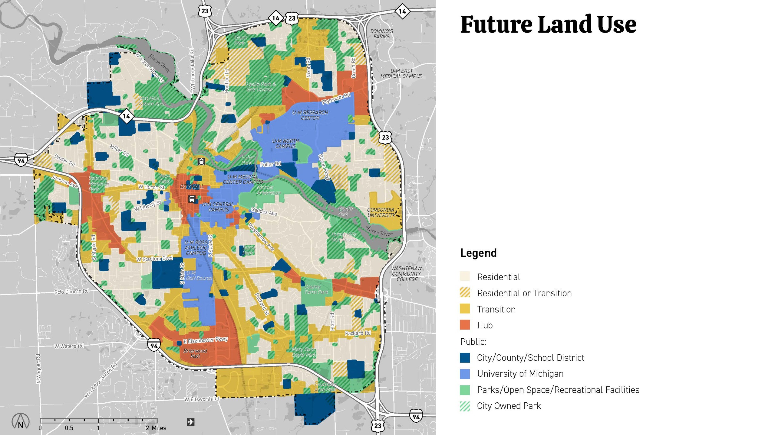
Unlike zoning, which provides a regulatory framework applied on a parcel-by-parcel basis, land use offers a broader, more flexible approach to planning. Recognizing that each property in the city is unique, the Future Land Use Map is designed with intentional flexibility, allowing certain boundaries to be fluid rather than strictly prescriptive.
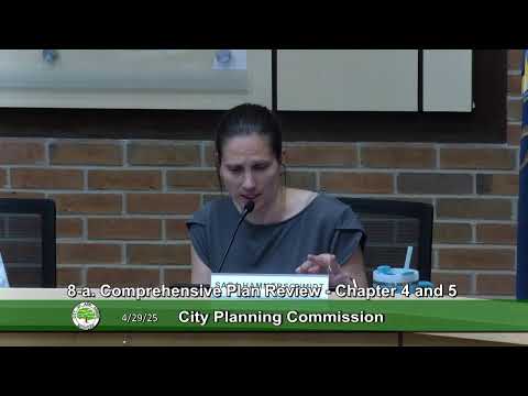
Planning Commission & City Council Meetings
Planning Commission Subcommittee Meetings
The Planning Commission appointed a sub-committee to help review and refine aspects of the plan. As of 2025, the discussions of the Comprehensive Plan were moved to Planning Commission.


Comprehensive Plan Steering Committee
The 16-person Steering Committee is a group of volunteers who applied for the committee position. Their role was to guide the process as "residents at large" and serve as a sounding board to discuss engagement opportunities, process and summarize feedback, and identify opportunities and issues for future consideration.


